30x30
Showing all 6 results
-
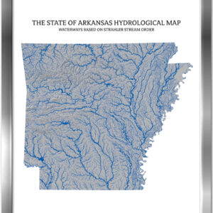
Arkansas- Rivers & Lakes Map
Price range: $229.00 through $329.00 -
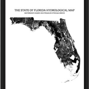
Florida- Rivers & Lakes Map
Price range: $229.00 through $329.00 -

Louisiana- Rivers & Lakes Map
Price range: $209.00 through $359.00 -

Missouri – Rivers & Lakes Map
Price range: $229.00 through $329.00 -
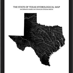
Texas- Rivers & Lakes Map
Price range: $229.00 through $329.00 -

West Virginia- Rivers & Lakes Map
Price range: $229.00 through $329.00


