River Basins, Black Frame
Showing 1–9 of 10 results
-

Colorado River Basins
$229.00 -
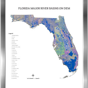
Florida River Basins
$229.00 -
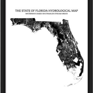
Florida- Rivers & Lakes Map
Price range: $229.00 through $329.00 -
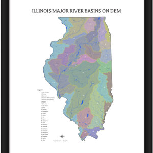
Illinois River Basins
$229.00 -
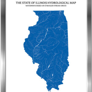
Illinois- Rivers & Lakes Map
Price range: $229.00 through $329.00 -

North Carolina River Basins
$229.00 -
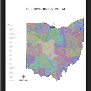
Ohio River Basins
$229.00 -

Texas River Basins
$229.00 -

Texas- Rivers & Lakes Map
Price range: $229.00 through $329.00


